• 3 min de lectura
• 3 min de lectura
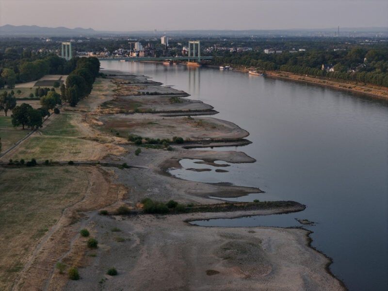
By Joe Wertz (Bloomberg) — Europe's first meaningful rains in weeks are unlikely to be widespread or sustained enough to quickly raise critically-low river levels, prolonging costly shipping and power supply restrictions as another spell of heat threatens to build.
Rain is expected this week across northern parts of the UK, the Alps and portions of central Europe, according to both government and commercial forecasts, with some areas set for heavy downpours. But precipitation will be sporadic in the regions hit hardest by drought and is unlikely to reverse the effects of weeks of record dryness and extreme heat. MetDesk meteorologist Richard Martin-Barton said it's "still not enough rainfall to make much impact on the low river flows."
Across Europe, disruptions along the largest rivers have forced barges to carry reduced loads, lifted freight costs and pushed cargo onto more expensive land routes, limiting the transport of chemicals, oil products and other goods. High water temperatures are also curbing power generation at riverside reactors from France to Hungary, adding pressure to electricity prices.
In the UK, "much of that rain will fall away from the areas where it is most needed," said Aidan McGivern of the UK Met Office in a video briefing. Elsewhere, rain over the upper Danube may be sufficient to prevent river levels from falling sharply in the immediate term, according to MetDesk's Martin-Barton, but is unlikely to restore flows there or in the Rhine after months of hot, dry weather
Meanwhile, heat-wave conditions will persist across central and southeastern Europe this week. Vienna reached 40.8C on Tuesday, a record for Austria, according to government forecaster GeoSphere. Average temperatures across the region are expected to run 5C to 8C above normal for much of the week, according to weather intelligence firm Vaisala.
Northwest Europe is set for a break from the heat, but the respite may prove brief. By early next week, high pressure is expected to build again over the region, potentially setting the stage for the continent's fifth major heat wave of the summer, according to models from the European Centre for Medium-Range Weather Forecasts.
If the pattern develops as projected, it will suppress moisture-bearing clouds and bring dry, sunny and unusually warm weather to much of Europe. Vaisala sees average temperatures next week around 2C to 6C above normal in France, Italy, southern Germany and southeastern Europe. That will also keep wildfire risks elevated in some countries.
"Once these background conditions are established, periods of gusty winds and low relative humidity can allow any fire that starts to spread quickly," said Vaisala meteorologist Matthew Dross.
Longer-range models indicate that unusually warm weather may persist through the end of August, though stormier intervals could interrupt the heat more frequently later in the month.
MetDesk meteorologist Piotr Abramczyk sees potential for cooler, wetter conditions to emerge in southeastern Europe around mid-month. Abnormally warm Mediterranean waters may enhance rainfall, particularly in the Balkans and along the Adriatic coast, where there is a risk of "excessive precipitation" in mid-August, he said.